After the Pemi Loop Run on July 6th, I quickly began planning to get out in the White Mountains for another long run before the summer was over. My initial plans were to do another Pemi Loop in the counterclockwise direction, but after learning of the closure of a portion of the Lincoln Woods Trail I started to think up a different adventure. I was looking for about 30 miles and over 10,000 feet of climbing. Since I have never tried a Presidential Traverse, I started thinking about doing a partial double traverse hitting all peaks including Clay and Franklin and tried to figure out what that would add up to for mileage. After searching the internet, I found a
recent trip report where Chris Dailey had done a double from South to North turning around at Madison. He listed his trip as 30.5 miles and 12,300 feet of climbing, and this sounded just right. There is another
report of Mats Roing and Jason doing the full double in recent years. Since Crawford Notch is a little higher in elevation than the start at Dolly Copp Campground we chose, our trip would probably be around 15,000 of climbing.
Since I had never spent an entire day above treeline on the Presidential Range before, I decided that I should probably invite a few people and started to think about some fellow mountain/ultra runners that would enjoy a torturous trip like this in the Whites. I invited Jerimy Arnold, a backcountry skiier and mountain runner, that has done a traverse on skis and run the traverse in the past. He brought his friend Nick who is also a backcountry skiier and runner and leads expeditions in the Antarctic. I also invited Dave Boudreau, a fellow ultrarunner, that I met at the GAC Fat Ass 50k race in January and has run Western States, Wapack 50 and other mountain ultras in the past. The invitation also extended to Eric Ahern, Josh Katzman and Ryan Davenport, but the date or in Eric's case an injury, didn't allow for them to attend. Our group consisted of Jerimy, Nick, and Dave.
 |
| Elevation Profile |
 |
| GPS Route, note the slow pace between Madison and Adams during the windy stretch |
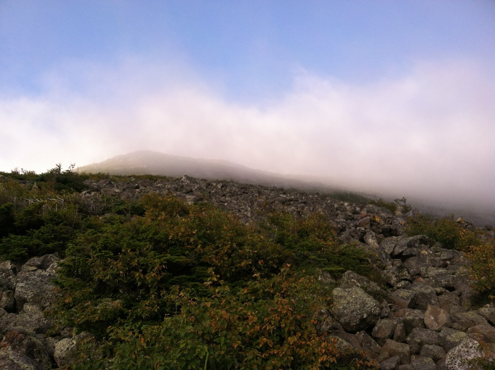
My plan was to meet everyone at the trailhead for a 5am start to try to take advantage of the dwindling daylight hours of the later date in the summer. The higher summits weather, that turned out to play a huge factor in our route for the day, was forecast to be in the clouds with wet trails and 25-45mph winds and 55mph gusts, 41 degrees for a high and a wind chill of 30. At 5:30am we began the climb up the Daniel Webster Scout trail to the summit of Mt. Madison. The climb up Madison starts out moderate until it reaches treeline and begins to ascend a little more steeply up a rock scramble to the top.
 |
| Some initial views from the climb up Daniel Webster Scout Trail on Mt. Madison |
 |
| Boulder field scrambling up Madison |
 |
| Looking up towards Madison's summit during a clear moment |
Ascending into the clouds seen above, visibility began to shrink to about 50 feet and we made our way from cairn to cairn as we approached Mt. Madison's summit. With the wind and wet rocks, we were sometimes reduced to a bent over hike in order to avoid getting knocked over by the winds. This made for some slow travel and discouraged our highly ambitious day of doing the entire range twice with the exception of descending Pierce.
 |
| Cairn to cairn progress |
 |
| Madison summit in the clouds |
Refueling at the Madison Hut, we made our way out into the clouds and ended up taking the Star Lake Trail, rather than Gulfside. It ended up being fine as they both climb up Mt. Adams to the summit, the Star Lake Trail takes less of a direct route.
 |
| Newly rebuilt Madison Hut |
 |
| Star Lake, its probably pretty nice if the weather was clear |
 |
| Great Gulf Wilderness sign |
 |
| On our way to Mt. Adams' summit |
Making our way up Mt. Adams we were greeted with the strongest winds of the day, I almost got knocked over right before this picture was taken - note the crouching that we were doing.
 |
| Mt. Adams summit in the wind |
 |
| Close to Thunderstorm Junction |
The winds started to soften and the clouds began to blow off as we approached Mt. Jefferson, which made the views much more impressive. Each time I am up on the Presidential Range, I am always amazed at the beauty of the mountains and the far reaching views.
 |
| Col between Mt. Adams and Mt. Jefferson |
 |
| Getting close to Jefferson's summit |
 |
| Looking down into the Great Gulf |
 |
| Cog Railway |
 |
| Looking down into Great Gulf towards Spaulding Lake |
 |
| Rails to the Clouds |
 |
| Almost at Mt. Washington's summit |
 |
| Mt. Washington summit buildings |
 |
| Cog railway train arriving |
Once we left the summit of Washington and headed down to the Lakes of the Clouds Hut and our fifth peak of the day, Monroe, the clouds had started to part and we got more glimpses of blue sky and far reaching views.
 |
| Overlooking Lakes of the Clouds Hut and Mt. Monroe |
 |
| Lakes of the Clouds |
 |
| Lakes of the Clouds with Mt. Monroe's summit on the left |
 |
| Looking towards our turnaround point, Mt. Pierce |
 |
| Looking back towards Mt. Monroe's sharp peak as it drops into Oakes Gulf |
 |
| Summit of Mt. Franklin: Dave, Jerimy, and I. Photo by Nick. |
 |
| Smooth section of trail towards Mt. Eisenhower |
 |
| Great running all the way to Mt Pierce (more or less) |
 |
| Looking back at most of our peaks from the day: (L-R) Jefferson, top of Adams, Washington, Monroe is the peak at far right, w/ Franklin in front |
 |
| 10 years almost to the day since I have been at Eisenhower's summit on my first 4,000 footer hike with my wife |
 |
| Bog bridges on the way to Pierce |
 |
| Nick, Jerimy, and Dave on Pierce's summit |
 |
| Me on Pierce's summit, overlooking our peaks from the day. |
After reaching Mt. Pierce's summit, Nick decided that his calf had bothered him enough for the day and headed down the trail towards Crawford Notch's Highland Center to catch a shuttle back to Pinkham Notch. This was his first long run out since tearing his calf muscle in June, nothing like starting with an easy jog through flat terrain. We made a plan to meet him there at 5:30pm and decided to bail on our original plans because of time and remaining daylight. The plans to run back to the car consisted of refueling back at Lakes of the Clouds Hut and taking the Lion Head Trail down along Tuckerman Ravine on Mt. Washington's East side. This would eliminate a lot of the climbing and allow us to get back to our cars and families at a reasonable hour after the long day out in the mountains. We all had long rides back and decided that the run across and returning back to Pinkham would be enough for the day.
The run back to the Lakes Hut went by quickly as a lot of the trail is runnable and we skipped the climbs to Eisenhower and Monroe's summits. We headed up the trail from Lakes and took the Tuckerman Crossover trail to the top of the headwall and made our way down the ridge of Lion Head. The steep descents were starting to take a toll on my legs and I was happy to arrive at the moderate grades of the lower part of the Tuckerman Ravine Trail for some easy walking on the way out to the car. We jogged the last hundred feet to close out the day in a good fashion at the Pinkham Notch Hut/Lodge and Nick was there to meet us. He had arrived about ten minutes ahead and gave us a ride back to Dolly Copp where our cars were.
I had a great day out in the mountains and feel if the start of the trail had not been so slow, we would have accomplished the semi-double traverse. I now have some unfinished business up on this ridge and plan to go back next year to complete the original plan, maybe I'll even try for the full Double Traverse, descending Pierce to Crawford Notch to add on about 6 miles and 3,000 feet of climbing. The guys I was running with were a great group and we had fun discussing backcountry skiing, ultras, and recent FKTs up in the Whites. I am glad that the weather improved as the day progressed because we got to enjoy the nice blue skies and views that make the Presidentials unique.
 |
| View into Tuckerman Ravine from Lion Head Trail. Photo by Jerimy. |
 |
| Dave and I taking a break on the way down Lion Head, Tuckerman's in the background. Photo by Jerimy. |
 |
| Tuckerman Ravine headwall. Photo by Jerimy. |
 |
| Hillman's Highway scar on the side of Tuckerman's. Photo by Jerimy. |
Totals for the day: 25.7 miles, 10,275 feet of climb, elapsed time 11hrs., 36 minutes
Summit Splits (moving time - not including resting or hot dog eating time at summit of Mt. Washington):
Madison (mile 4): 1:28
Adams (mile 5.4): 1:56
Jefferson (mile 7.5): 2:30
Clay (mile 9): 3:00
Washington (mile 10.5) 3:20
Monroe (mile 13): 4:00
Eisenhower (mile 15.4): 4:30
Pierce (mile 17.1 & turnaround): 4:53, moving time about 7.5 hours excluding all the time at the huts and resting on the trail.
Gear used:
Shoes: Inov8 Roclite 295
Shirt:
North Face Velocitee Crew
Shorts: Under Armour
Socks:
Darn Tough Run Cushion sock
Hat:
Outdoor Research Swift Cap
Winter Hat:
Outdoor Research WindPro
Jacket:
Montane Marathon Ultralight
Pack:
GoLite Rush 14L
I am starting to get the long mountain runs dialed in for gear, using a
similar setup to what I did when I ran the Pemi Loop in July. This time I
brought a winter hat and definitely needed it, the Outdoor Research
WindPro performed well and didn't make me overheated as we ran from
Madison to Jefferson in the chilly winds. The Inov8 Roclite 295s grip the wet rocks well and provide the right amount of protection for me on the sharp rocks of the Presi's. I used the Montane Marathon jacket for a lot of the windier sections, which allowed me to block the wind well while allowing my upper body to breathe. I never felt overheated using this, and with its small packable nature, it will be a go-to jacket for future mountain runs.
Fuel:
Water mixed with Gatorade powder
Gu Gels (7 or so)
Succeed S-Caps (2)
1 hot dog
2 chocolate chip cookies
Trail mix - homemade
Peanut butter & jelly sandwiches (2)
Recovery Drink:
Wachusett Brewery Larry Imperial IPA
For fueling, I did try something different that seemed to work well for a portion of the Pemi Loop. I added a small amount of Gatorade powder to my water bladder. This seemed to keep my electrolyte levels constant and I never bonked or got behind on my hydration like I did on the Pemi. I tried to eat a gel every 45 minutes and since it was not as hot, I was not sweating nearly as much as earlier in the summer.
Mid-September I am thinking about doing a long mountain run at Mt. Monadnock, maybe around 8 hours and then the next race will be the TARC Fall Classic 50k at Great Brook Farm in Stow.


Nice recovery drink. ;)
ReplyDeleteAwesome views. Love all the fog pics. I think I'd stay away from Thunderstorm junction. Well at list mid day. haha. "torturous trip". haha. not kidding but looks like it was great times.
Thanks for reading Christine. We had a fun day out in the mountains.
DeleteGreat write up and pics Jesse, thanks for sending me the link! You have the right idea about the full double presi by heading north to south first. Every time I do it I stand on Madison and say "There's no way in hell I'm going back down to Appalachia or Pinkham Road B and back up, I think I'll just turn around now!"
ReplyDeleteHope you get back up to the Whites soon!
Thanks for reading, Chris. And I agree, it sounds much more daunting to go down Madison than it would to go down and back up Pierce. I haven't completed it yet, but plan to give it another try.
Delete